Geolocate

Halytskyi District topographic map

Click on the map to display elevation.

About this map
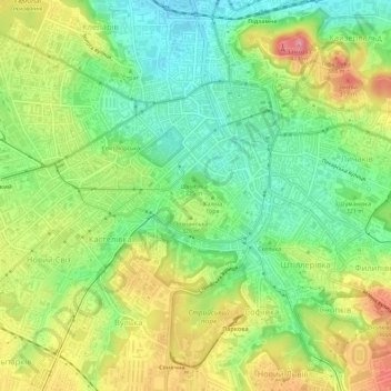
Name: Halytskyi District topographic map, elevation, terrain.

Location: Halytskyi District, Lviv, Lviv Urban Hromada, Lviv Raion, Lviv Oblast, Ukraine (49.81584 24.00387 49.85234 24.05568)

Average elevation: 1,033 ft

Minimum elevation: 879 ft

Maximum elevation: 1,240 ft

Other topographic maps

Click on a map to view its topography, its elevation and its terrain.

X

Ukraine > Lviv Oblast > Lviv

Average elevation: 1,099 ft

Gear up for your next adventure:

🧭Outdoor Navigation Book - Learn advanced navigation skills
👟Men's Trail Runners - Lightweight footwear for fast-paced exploration and light hiking
🩳Quick‑Dry Hiking Shorts - Comfortable and quick‑dry shorts for summer hiking
🔪Outdoor Multitools - Essential survival tools for gear repair and field use
🏫Relief Map Kits - Hands-on tools for teaching landforms and elevation

As an Amazon Associate, this site earns from qualifying purchases at no extra cost to you.