
Parroquia Andrés Bello topographic map
Interactive map
Click on the map to display elevation.
About this map
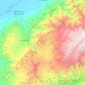
Name: Parroquia Andrés Bello topographic map, elevation, terrain.
Average elevation: 5,814 ft
Minimum elevation: 39 ft
Maximum elevation: 14,331 ft