
Winnfield topographic map
Interactive map
Click on the map to display elevation.
About this map
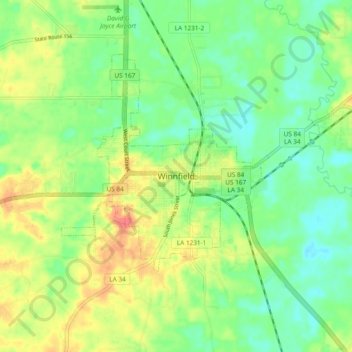
Name: Winnfield topographic map, elevation, terrain.
Location: Winnfield, Winn Parish, Louisiana, 71483, United States (31.88523 -92.67994 31.96523 -92.59994)
Average elevation: 128 ft
Minimum elevation: 59 ft
Maximum elevation: 223 ft
Winnfield has an elevation of 128 feet (39.0 m). According to the United States Census Bureau, the city has a total area of 3.3 square miles (8.6 km2), all land. North and west of Winnfield, Saline Bayou, a National Wild and Scenic Rivers System waterway, offers blackwater canoeing as well as fishing.