Geolocate

Cyberjaya topographic map

Click on the map to display elevation.

About this map

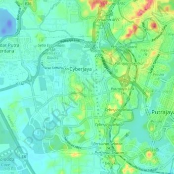
Name: Cyberjaya topographic map, elevation, terrain.

Location: Cyberjaya, Selangor, 63000, Malaysia (2.88524 101.60849 2.96524 101.68849)

Average elevation: 79 ft

Minimum elevation: -118 ft

Maximum elevation: 364 ft

Gear up for your next adventure:

Backpacking Tents - Weight-optimized shelters for multi-day topographic surveys
🪶Compact Camp Shovel - Folding shovel for campsite tasks
🛠️Backpacking Tool Kit - Essential toolkit for outdoor repairs
🥤Water Filter Bottle - All‑in‑one filter bottle for safe hydration
🕶️Glacier Sunglasses - Side shields to protect eyes from high-altitude snow glare

As an Amazon Associate, this site earns from qualifying purchases at no extra cost to you.