
Niedere Börde topographic map
Interactive map
Click on the map to display elevation.
About this map
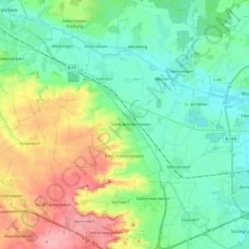
Name: Niedere Börde topographic map, elevation, terrain.
Location: Niedere Börde, Börde, Saxe-Anhalt, Allemagne (52.16911 11.45777 52.29596 11.60520)
Average elevation: 233 ft
Minimum elevation: 125 ft
Maximum elevation: 469 ft
Other topographic maps
Click on a map to view its topography, its elevation and its terrain.
Florenne
Allemagne > Saxe-Anhalt > Börde > Niedere Börde
Florenne, Klein Ammensleben, Niedere Börde, Börde, Saxe-Anhalt, Allemagne
Average elevation: 262 ft