
Walk topographic map
Interactive map
Click on the map to display elevation.
About this map
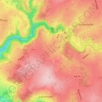
Name: Walk topographic map, elevation, terrain.
Location: Walk, Waimes, Verviers, Liège, Wallonie, 4950, Belgique (50.42451 6.08105 50.46451 6.12105)
Average elevation: 1,726 ft
Minimum elevation: 1,257 ft
Maximum elevation: 1,955 ft