
Kayquit topographic map
Interactive map
Click on the map to display elevation.
About this map
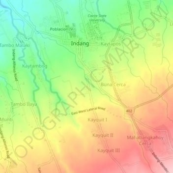
Name: Kayquit topographic map, elevation, terrain.
Location: Kayquit, Indang, Cavite, Calabarzon, 4122, Philippines (14.16579 120.86001 14.20579 120.90001)
Average elevation: 1,066 ft
Minimum elevation: 774 ft
Maximum elevation: 1,348 ft