
Auchnagatt topographic map
Interactive map
Click on the map to display elevation.
About this map
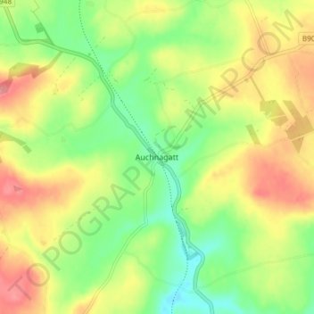
Name: Auchnagatt topographic map, elevation, terrain.
Location: Auchnagatt, Aberdeenshire, Scotland, AB41 8UR, United Kingdom (57.44638 -2.13680 57.48638 -2.09680)
Average elevation: 315 ft
Minimum elevation: 180 ft
Maximum elevation: 463 ft