
Sutri topographic map
Interactive map
Click on the map to display elevation.
About this map
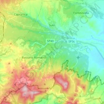
Name: Sutri topographic map, elevation, terrain.
Location: Sutri, Viterbe, Latium, 01015, Italie (42.17748 12.18186 42.26907 12.29567)
Average elevation: 1,191 ft
Minimum elevation: 794 ft
Maximum elevation: 1,949 ft