
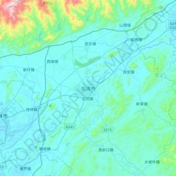
北流市 topographic map
Interactive map
Click on the map to display elevation.
About this map
Name: 北流市 topographic map, elevation, terrain.
Location: 北流市, 陵城街道, 北流市, 玉林市, 广西壮族自治区, 543000, 中国 (22.54688 110.19028 22.86688 110.51028)
Average elevation: 620 ft
Minimum elevation: 240 ft
Maximum elevation: 4,072 ft
北流地处北回归线以南,属典型的亚热带季风气候,年平均气温21℃,雨量充沛,降水量1627毫米。光照充足,土地肥沃。全市地形大都为低山和丘陵,境内石灰石、高岭土储量极大。