
Surabaya topographic map
Interactive map
Click on the map to display elevation.
About this map
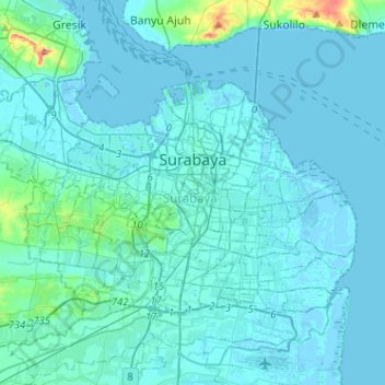
Name: Surabaya topographic map, elevation, terrain.
Location: Surabaya, Jawa Timur, Indonesia (-7.35144 112.59157 -7.18423 112.84668)
Average elevation: 26 ft
Minimum elevation: -13 ft
Maximum elevation: 351 ft
Other topographic maps
Click on a map to view its topography, its elevation and its terrain.