
Inveroran topographic map
Interactive map
Click on the map to display elevation.
About this map
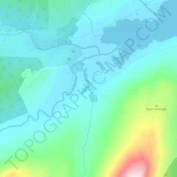
Name: Inveroran topographic map, elevation, terrain.
Location: Inveroran, Argyll and Bute, Scotland, PA36 4AQ, United Kingdom (56.52289 -4.81827 56.54289 -4.79827)
Average elevation: 745 ft
Minimum elevation: 528 ft
Maximum elevation: 1,617 ft
Other topographic maps
Click on a map to view its topography, its elevation and its terrain.
Bridge of Orchy
United Kingdom > Scotland > Argyll and Bute
Bridge of Orchy, Argyll and Bute, Scotland, PA36 4AD, United Kingdom
Average elevation: 1,063 ft