Geolocate

Valley Pellice topographic map

Click on the map to display elevation.

About this map

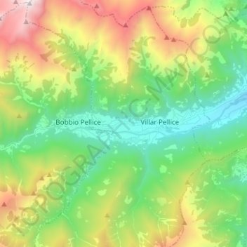
Name: Valley Pellice topographic map, elevation, terrain.

Location: Valley Pellice, Villar Pellice, Torino, Piedmont, Italy (44.79859 7.07860 44.81594 7.20216)

Average elevation: 4,390 ft

Minimum elevation: 1,798 ft

Maximum elevation: 9,367 ft

Gear up for your next adventure:

📌Outdoor GPS Map App - Apps and devices for digital topographic navigation
📶Vehicle Signal Boosters - Improve reception in rural areas while driving to trailheads
🧦Merino Wool Socks - Moisture-wicking, blister-preventing socks for long treks
🛰️Handheld GPS Units - Professional satellite navigators for precise backcountry mapping
🎒Hydration Pack - Hands‑free water reservoir for long hikes

As an Amazon Associate, this site earns from qualifying purchases at no extra cost to you.