
Buluh Awar topographic map
Interactive map
Click on the map to display elevation.
About this map
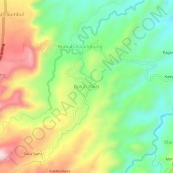
Name: Buluh Awar topographic map, elevation, terrain.
Location: Buluh Awar, Deli Serdang, North Sumatra, 20357, Indonesia (3.27703 98.57465 3.31703 98.61465)
Average elevation: 1,637 ft
Minimum elevation: 1,102 ft
Maximum elevation: 2,392 ft