Geolocate

Tehri Dam topographic map

Click on the map to display elevation.

About this map
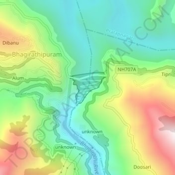
Name: Tehri Dam topographic map, elevation, terrain.

Location: Tehri Dam, Bhagirathipuram, Tehri, Tehri Garhwal, Uttarakhand, India (30.37373 78.47715 30.37852 78.48361)

Average elevation: 2,969 ft

Minimum elevation: 1,975 ft

Maximum elevation: 4,744 ft

Other topographic maps

Click on a map to view its topography, its elevation and its terrain.

bagi

India > Uttarakhand > Tehri > Bhagirathipuram

Average elevation: 3,497 ft

Gear up for your next adventure:

🛌Ultralight Sleeping Bags - Compact down bags for cold nights in the wilderness
😴Insulated Sleeping Pads - Compact and warm pads for high-elevation camping
🔌USB Car Charger - Car charger for on‑the‑go power needs
🧭Outdoor Navigation Book - Learn advanced navigation skills
🧢Outdoor Hiking Hat - Sun protection hat for outdoor explorers

As an Amazon Associate, this site earns from qualifying purchases at no extra cost to you.