
Richmond River topographic map
Interactive map
Click on the map to display elevation.
About this map
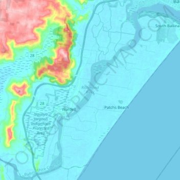
Name: Richmond River topographic map, elevation, terrain.
Average elevation: 75 ft
Minimum elevation: -7 ft
Maximum elevation: 607 ft
Other topographic maps
Click on a map to view its topography, its elevation and its terrain.
Cabbage Tree Island
Australia > New South Wales > Wardell > Cabbage Tree Island
Cabbage Tree Island, Wardell, Ballina Shire Council, New South Wales, 2477, Australia
Average elevation: 13 ft
Wardell
Australia > New South Wales > Wardell
Wardell, Ballina Shire Council, New South Wales, Australia
Average elevation: 16 ft