
Goose Pond topographic map
Interactive map
Click on the map to display elevation.
About this map
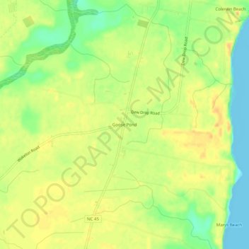
Name: Goose Pond topographic map, elevation, terrain.
Location: Goose Pond, Bertie County, North Carolina, USA (36.15794 -76.79495 36.19794 -76.75495)
Average elevation: 62 ft
Minimum elevation: -20 ft
Maximum elevation: 102 ft