
San Isidro Miranda topographic map
Interactive map
Click on the map to display elevation.
About this map
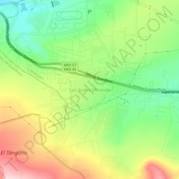
Name: San Isidro Miranda topographic map, elevation, terrain.
Location: San Isidro Miranda, El Marqués, Querétaro, 76240, México (20.54990 -100.34357 20.58990 -100.30357)
Average elevation: 6,670 ft
Minimum elevation: 6,240 ft
Maximum elevation: 7,234 ft