Geolocate

Enterprise topographic map

Click on the map to display elevation.

About this map

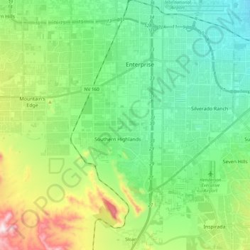
Name: Enterprise topographic map, elevation, terrain.

Location: Enterprise, Sloan, Clark County, Nevada, United States (35.92896 -115.34511 36.07689 -115.15440)

Average elevation: 2,536 ft

Minimum elevation: 1,965 ft

Maximum elevation: 4,009 ft

Clark County trails, hiking, mountain biking, running and outdoor activities

Gear up for your next adventure:

🩳Quick‑Dry Hiking Shorts - Comfortable and quick‑dry shorts for summer hiking
☀️Outdoor Sunscreen - High protection sunscreen for outdoor activities
🥾Hiking Shoes - Durable and comfortable shoes for trail hiking
🧷Carabiner Set - Durable clips for gear attachment
🥤Water Filter Bottle - All‑in‑one filter bottle for safe hydration

As an Amazon Associate, this site earns from qualifying purchases at no extra cost to you.