
河南蒙古族自治县 topographic map
Interactive map
Click on the map to display elevation.
About this map
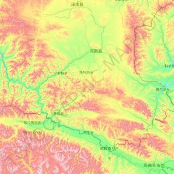
Name: 河南蒙古族自治县 topographic map, elevation, terrain.
Location: 河南蒙古族自治县, 黄南藏族自治州, Qinghai, 811599, China (34.08142 100.89282 34.91416 102.25772)
Average elevation: 12,418 ft
Minimum elevation: 10,689 ft
Maximum elevation: 15,466 ft