
Muldenhammer topographic map
Interactive map
Click on the map to display elevation.
About this map
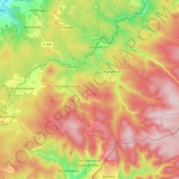
Name: Muldenhammer topographic map, elevation, terrain.
Location: Muldenhammer, Vogtlandkreis, Saxony, Germany (50.39658 12.39379 50.46981 12.58391)
Average elevation: 2,448 ft
Minimum elevation: 1,585 ft
Maximum elevation: 3,192 ft