
Overwinden topographic map
Interactive map
Click on the map to display elevation.
About this map
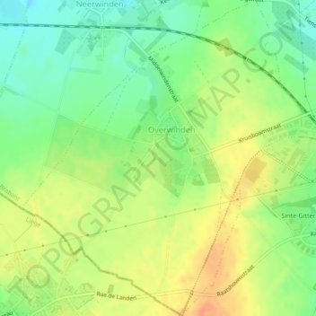
Name: Overwinden topographic map, elevation, terrain.
Location: Overwinden, Landen, Louvain, Brabant flamand, Flandre, Belgique (50.73908 5.02627 50.76598 5.06169)
Average elevation: 272 ft
Minimum elevation: 203 ft
Maximum elevation: 341 ft
Other topographic maps
Click on a map to view its topography, its elevation and its terrain.
Neerlanden
Neerlanden, Landen, Louvain, Brabant flamand, Flandre, Belgique
Average elevation: 197 ft