
Puncak Jaya topographic map
Interactive map
Click on the map to display elevation.
About this map
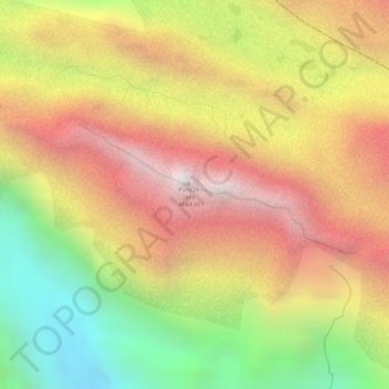
Name: Puncak Jaya topographic map, elevation, terrain.
Location: Puncak Jaya, Mimika, Papua, Indonesia (-4.07946 137.15897 -4.07936 137.15907)
Average elevation: 13,993 ft
Minimum elevation: 11,706 ft
Maximum elevation: 15,810 ft
Other topographic maps
Click on a map to view its topography, its elevation and its terrain.
Undundi-Wandandi
Undundi-Wandandi, Paniai, Papua, Indonesia
Average elevation: 10,449 ft
East Northwall Firn
East Northwall Firn, Mimika, Papua, Indonesia
Average elevation: 14,396 ft
Maoke Mountains
Maoke Mountains, Trikora District, Jayawijaya, Papua, Indonesia
Average elevation: 9,377 ft