
Situbondo topographic map
Interactive map
Click on the map to display elevation.
About this map
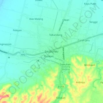
Name: Situbondo topographic map, elevation, terrain.
Location: Situbondo, Jatim, 68311, Indonésie (-7.74678 113.96541 -7.66678 114.04541)
Average elevation: 131 ft
Minimum elevation: 3 ft
Maximum elevation: 584 ft