
Pisgah Mountain topographic map
Interactive map
Click on the map to display elevation.
About this map
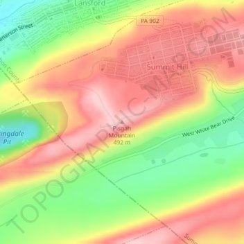
Name: Pisgah Mountain topographic map, elevation, terrain.
Average elevation: 1,322 ft
Minimum elevation: 968 ft
Maximum elevation: 1,601 ft
Other topographic maps
Click on a map to view its topography, its elevation and its terrain.
White Bear Creek
United States > Pennsylvania > Carbon County > Summit Hill
White Bear Creek, Summit Hill, Carbon County, Pennsylvania, 18250, United States
Average elevation: 1,332 ft