Geolocate

Beech Mountain topographic map

Click on the map to display elevation.
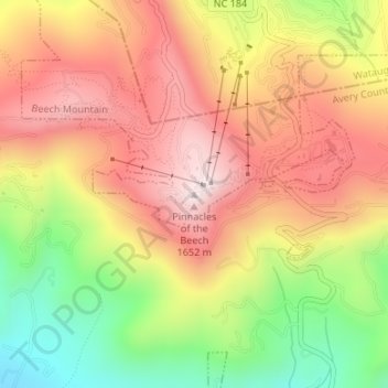
Beech Mountain

Beech Mountain is a mountain in the North Carolina High Country and wholly in the Pisgah National Forest. Its elevation reaches 5,506 feet (1,657 m) and generates feeder streams for the Elk River. Nestled on the top is the Town of Beech Mountain.

Wikipedia (CC-BY-SA 3.0)

About this map

Name: Beech Mountain topographic map, elevation, terrain.

Location: Beech Mountain, Avery County, North Carolina, 28604, United States (36.18452 -81.88155 36.18462 -81.88145)

Average elevation: 4,701 ft

Minimum elevation: 3,743 ft

Maximum elevation: 5,456 ft

Avery County trails, hiking, mountain biking, running and outdoor activities

Gear up for your next adventure:

🪶Wildlife Field Guides - Learn animal tracking and species ID
📚Navigation Handbooks - Master the art of reading topographic maps and using a compass
👓Polarized Sunglasses - Outdoor sunglasses for glare reduction
🥄Camping Utensil Set - Lightweight utensils for outdoor meals
📷Action Cameras - Rugged cameras to document your journeys across rugged terrain

As an Amazon Associate, this site earns from qualifying purchases at no extra cost to you.