
Mahayag topographic map
Interactive map
Click on the map to display elevation.
About this map
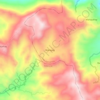
Name: Mahayag topographic map, elevation, terrain.
Average elevation: 2,654 ft
Minimum elevation: 1,640 ft
Maximum elevation: 3,278 ft
Other topographic maps
Click on a map to view its topography, its elevation and its terrain.
Tigwa River
Philippines > Bukidnon > San Fernando
Tigwa River, San Fernando, Bukidnon, Northern Mindanao, 8711, Philippines
Average elevation: 2,201 ft