
Jalajil topographic map
Interactive map
Click on the map to display elevation.
About this map
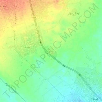
Name: Jalajil topographic map, elevation, terrain.
Location: Jalajil, Tuban District, Lahij Governorate, Yemen (12.99818 44.87656 13.03818 44.91656)
Average elevation: 308 ft
Minimum elevation: 240 ft
Maximum elevation: 390 ft
Other topographic maps
Click on a map to view its topography, its elevation and its terrain.
النجاد
Yemen > Lahij Governorate > لعدان الجهاور
النجاد, لعدان الجهاور, Al Maflahy District, Lahij Governorate, Yemen
Average elevation: 7,224 ft
Al Ma`an
Yemen > Lahij Governorate > Al Ma`an
Al Ma`an, Al Qabbaytah District, Lahij Governorate, Yemen
Average elevation: 3,622 ft
El Hajaf
Yemen > Lahij Governorate > El Hajaf
El Hajaf, Al Musaymir District, Lahij Governorate, Yemen
Average elevation: 3,094 ft