Geolocate

Luchon-Superbagnères topographic map

Interactive map

Click on the map to display elevation.

About this map

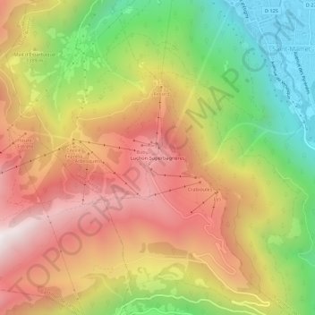
Name: Luchon-Superbagnères topographic map, elevation, terrain.

Location: Luchon-Superbagnères, Saint-Aventin, Saint-Gaudens, Haute-Garonne, Okzitanien, Metropolitanes Frankreich, 31110, Frankreich (42.74830 0.55802 42.78830 0.59802)

Average elevation: 4,367 ft

Minimum elevation: 2,060 ft

Maximum elevation: 6,499 ft

Es gehört zur Gemeinde Saint-Aventin nahe Bagnères-de-Luchon im Département Haute-Garonne in der Region Okzitanien. Der Talort Bagnères-de-Luchon liegt auf 630 Metern Höhe, Superbagnères auf 1440 bis 2160 Metern Höhe.