
Eufaula topographic map
Interactive map
Click on the map to display elevation.
About this map
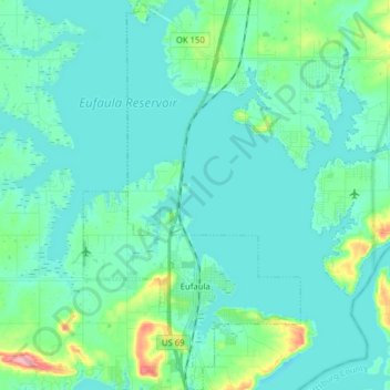
Name: Eufaula topographic map, elevation, terrain.
Location: Eufaula, McIntosh County, Oklahoma, 74432, United States (35.25326 -95.62789 35.38166 -95.53996)
Average elevation: 623 ft
Minimum elevation: 568 ft
Maximum elevation: 922 ft
Other topographic maps
Click on a map to view its topography, its elevation and its terrain.
Texanna
United States > Oklahoma > McIntosh County
Texanna, McIntosh County, Oklahoma, United States
Average elevation: 643 ft
Rentiesville
United States > Oklahoma > McIntosh County
Rentiesville, McIntosh County, Oklahoma, 74459, United States
Average elevation: 594 ft
Checotah
United States > Oklahoma > McIntosh County
Checotah, McIntosh County, Oklahoma, 74426, United States
Average elevation: 620 ft