
La Grange Montagne topographic map
Interactive map
Click on the map to display elevation.
About this map
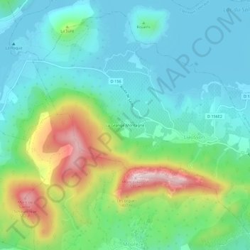
Name: La Grange Montagne topographic map, elevation, terrain.
Average elevation: 787 ft
Minimum elevation: 443 ft
Maximum elevation: 1,683 ft
Other topographic maps
Click on a map to view its topography, its elevation and its terrain.
Ruisseau du Mas Crémat
France > Occitanie > Hérault > Liausson > Le Mas de l'Église
Ruisseau du Mas Crémat, Le Mas de l'Église, Liausson, Lodève, Hérault, Occitanie, France métropolitaine, 34800, France
Average elevation: 702 ft
Le Mas de l'Église
France > Occitanie > Hérault > Liausson
Le Mas de l'Église, Liausson, Lodève, Hérault, Occitanie, France métropolitaine, 34800, France
Average elevation: 715 ft