
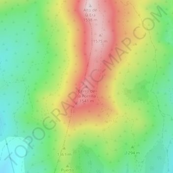
Cerro de la Porrilla topographic map
Interactive map
Click on the map to display elevation.
About this map
Name: Cerro de la Porrilla topographic map, elevation, terrain.
Average elevation: 4,364 ft
Minimum elevation: 3,717 ft
Maximum elevation: 5,230 ft
Other topographic maps
Click on a map to view its topography, its elevation and its terrain.
Tejera Negra
España > Comunidad de Madrid > Horcajuelo de la Sierra
Tejera Negra, Horcajuelo de la Sierra, Sierra Norte, Comunidad de Madrid, España
Average elevation: 5,358 ft