
Rutland topographic map
Interactive map
Click on the map to display elevation.
About this map
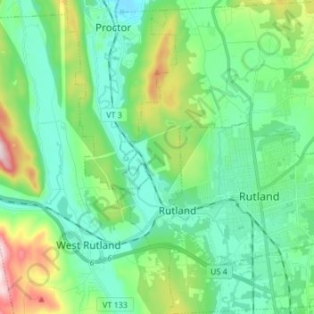
Name: Rutland topographic map, elevation, terrain.
Location: Rutland, Rutland County, Vermont, 05736, United States (43.57173 -73.03284 43.66948 -72.93476)
Average elevation: 751 ft
Minimum elevation: 351 ft
Maximum elevation: 1,985 ft