Lac Grand topographic map
Interactive map
Click on the map to display elevation.
About this map
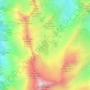
Name: Lac Grand topographic map, elevation, terrain.
Average elevation: 8,002 ft
Minimum elevation: 6,535 ft
Maximum elevation: 9,744 ft

Click on the map to display elevation.
Name: Lac Grand topographic map, elevation, terrain.
Average elevation: 8,002 ft
Minimum elevation: 6,535 ft
Maximum elevation: 9,744 ft