
Lauter topographic map
Interactive map
Click on the map to display elevation.
About this map
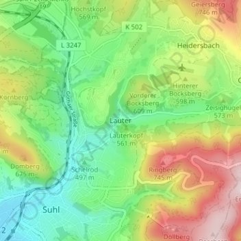
Name: Lauter topographic map, elevation, terrain.
Location: Lauter, Suhl, Thüringen, 98527, Deutschland (50.60343 10.69082 50.64343 10.73082)
Average elevation: 1,867 ft
Minimum elevation: 1,371 ft
Maximum elevation: 2,667 ft