
Riosucio topographic map
Interactive map
Click on the map to display elevation.
About this map
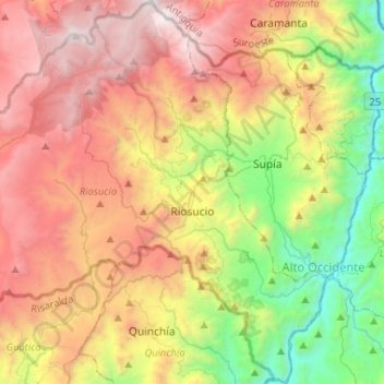
Name: Riosucio topographic map, elevation, terrain.
Average elevation: 6,234 ft
Minimum elevation: 2,090 ft
Maximum elevation: 10,643 ft
Other topographic maps
Click on a map to view its topography, its elevation and its terrain.
Villamaría
Colombie > Caldas > Villamaría
Villamaría, Centrosur, Caldas, Colombie
Average elevation: 7,884 ft