
Municipio Curahuara de Carangas topographic map
Interactive map
Click on the map to display elevation.
About this map
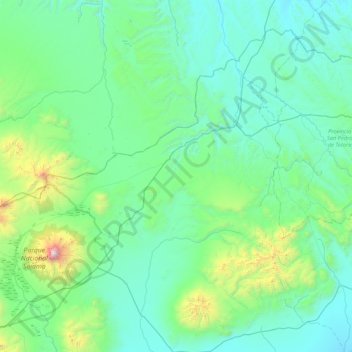
Name: Municipio Curahuara de Carangas topographic map, elevation, terrain.
Average elevation: 13,550 ft
Minimum elevation: 12,405 ft
Maximum elevation: 21,371 ft
Other topographic maps
Click on a map to view its topography, its elevation and its terrain.
Nevado Sajama
Bolivia > Oruro > Municipio Curahuara de Carangas
Nevado Sajama, Municipio Curahuara de Carangas, Provincia Sajama, Oruro, Bolivia
Average elevation: 19,032 ft