
Saint-Alban-des-Villards topographic map
Interactive map
Click on the map to display elevation.
About this map
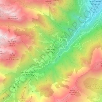
Name: Saint-Alban-des-Villards topographic map, elevation, terrain.
Average elevation: 4,882 ft
Minimum elevation: 1,545 ft
Maximum elevation: 8,383 ft