
Candarave topographic map
Interactive map
Click on the map to display elevation.
About this map
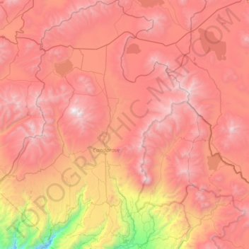
Name: Candarave topographic map, elevation, terrain.
Location: Candarave, Provincia de Candarave, Tacna, Perú (-17.34191 -70.46502 -16.77043 -70.06989)
Average elevation: 14,583 ft
Minimum elevation: 8,097 ft
Maximum elevation: 19,022 ft