
Jehanabad topographic map
Interactive map
Click on the map to display elevation.
About this map
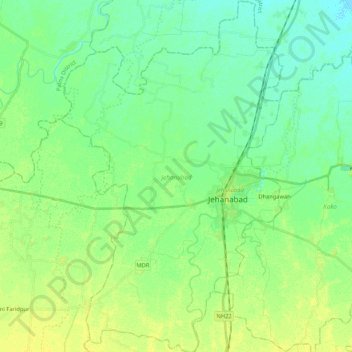
Name: Jehanabad topographic map, elevation, terrain.
Location: Jehanabad, Bihar, India (25.12766 84.88677 25.31897 85.02060)
Average elevation: 213 ft
Minimum elevation: 187 ft
Maximum elevation: 243 ft