Geolocate

Province of Andahuaylas topographic map

Click on the map to display elevation.

About this map

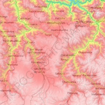
Name: Province of Andahuaylas topographic map, elevation, terrain.

Location: Province of Andahuaylas, Apurímac, Peru (-14.54431 -73.74789 -13.41172 -72.94463)

Average elevation: 12,073 ft

Minimum elevation: 3,714 ft

Maximum elevation: 17,064 ft

Gear up for your next adventure:

🎒Trekking Poles - Sturdy poles for balance and stability on rough terrain
🥩Freeze-Dried Meals - Nutritious and lightweight food for remote expeditions
🪵Folding Camp Saw - Compact saw for wood and campsite work
🔋Rechargeable Batteries - Power up your outdoor devices
🪶Trail Camera - Capture wildlife on your hikes

As an Amazon Associate, this site earns from qualifying purchases at no extra cost to you.