
Øvre Engesland topographic map
Interactive map
Click on the map to display elevation.
About this map
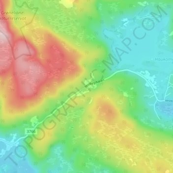
Name: Øvre Engesland topographic map, elevation, terrain.
Location: Øvre Engesland, Birkenes, Agder, 4768, Norwegen (58.51727 8.05287 58.55727 8.09287)
Average elevation: 1,165 ft
Minimum elevation: 823 ft
Maximum elevation: 1,713 ft