
St Arvans topographic map
Interactive map
Click on the map to display elevation.
About this map
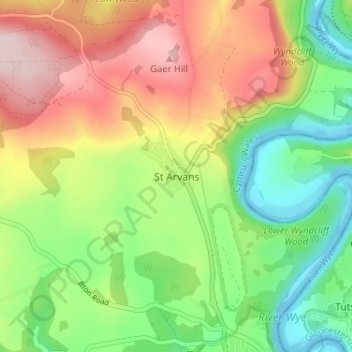
Name: St Arvans topographic map, elevation, terrain.
Location: St Arvans, Monmouthshire, Wales, NP16 6EP, United Kingdom (51.64494 -2.71889 51.68494 -2.67889)
Average elevation: 397 ft
Minimum elevation: -26 ft
Maximum elevation: 909 ft