
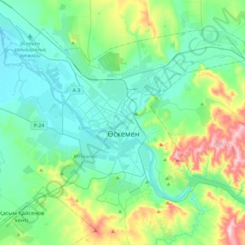
Oskemen topographic map
Interactive map
Click on the map to display elevation.
About this map
Name: Oskemen topographic map, elevation, terrain.
Average elevation: 1,198 ft
Minimum elevation: 889 ft
Maximum elevation: 2,297 ft
Other topographic maps
Click on a map to view its topography, its elevation and its terrain.
Irtysh
Kazakhstan > East Kazakhstan Region > Oskemen
Irtysh, Oskemen, East Kazakhstan Region, 070009, Kazakhstan
Average elevation: 915 ft