
Bad Lobenstein topographic map
Interactive map
Click on the map to display elevation.
About this map
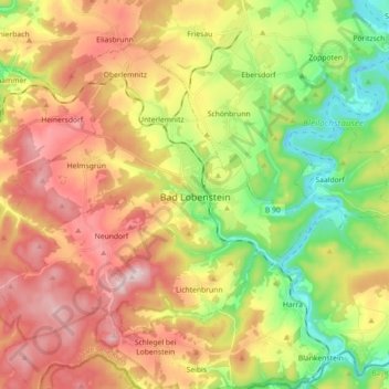
Name: Bad Lobenstein topographic map, elevation, terrain.
Location: Bad Lobenstein, Saale-Orla-Kreis, Thuringe, 07356, Allemagne (50.40596 11.55394 50.49391 11.73349)
Average elevation: 1,837 ft
Minimum elevation: 1,302 ft
Maximum elevation: 2,415 ft
Other topographic maps
Click on a map to view its topography, its elevation and its terrain.
Schleiz
Allemagne > Thuringe > Saale-Orla-Kreis
Schleiz, Saale-Orla-Kreis, Thuringe, 07907, Allemagne
Average elevation: 1,575 ft
Mittelpöllnitz
Allemagne > Thuringe > Saale-Orla-Kreis
Mittelpöllnitz, Triptis, Saale-Orla-Kreis, Thuringe, Allemagne
Average elevation: 1,145 ft