
Cape Town Ward 98 topographic map
Interactive map
Click on the map to display elevation.
About this map
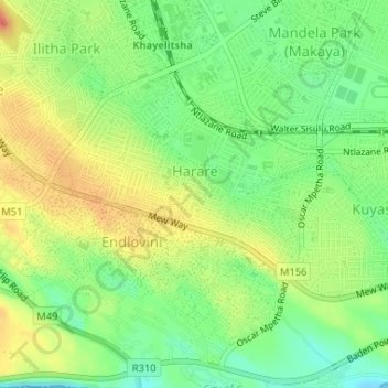
Name: Cape Town Ward 98 topographic map, elevation, terrain.
Average elevation: 89 ft
Minimum elevation: -3 ft
Maximum elevation: 184 ft
Other topographic maps
Click on a map to view its topography, its elevation and its terrain.
Cape Town Ward 89
RSA > Western Cape > Khayelitsha
Cape Town Ward 89, Khayelitsha, City of Cape Town, Western Cape, RSA
Average elevation: 95 ft