
Weyher in der Pfalz topographic map
Interactive map
Click on the map to display elevation.
About this map
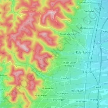
Name: Weyher in der Pfalz topographic map, elevation, terrain.
Location: Weyher in der Pfalz, Edenkoben, Rhineland-Palatinate, Germany (49.25928 7.93755 49.30192 8.09464)
Average elevation: 1,037 ft
Minimum elevation: 433 ft
Maximum elevation: 2,195 ft