
Campos del Río topographic map
Interactive map
Click on the map to display elevation.
About this map
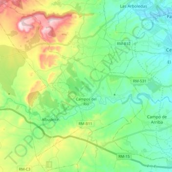
Name: Campos del Río topographic map, elevation, terrain.
Location: Campos del Río, Río Mula, Región de Murcia, 30191, España (37.98991 -1.44041 38.11349 -1.30078)
Average elevation: 732 ft
Minimum elevation: 272 ft
Maximum elevation: 1,814 ft