
Tynaarlo topographic map
Interactive map
Click on the map to display elevation.
About this map
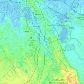
Name: Tynaarlo topographic map, elevation, terrain.
Location: Tynaarlo, Drenthe, Nederland (53.02578 6.48030 53.19831 6.77651)
Average elevation: 16 ft
Minimum elevation: -23 ft
Maximum elevation: 69 ft
Other topographic maps
Click on a map to view its topography, its elevation and its terrain.