
El Paraiso topographic map
Interactive map
Click on the map to display elevation.
About this map
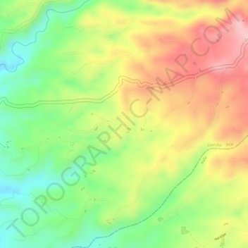
Name: El Paraiso topographic map, elevation, terrain.
Average elevation: 4,856 ft
Minimum elevation: 4,547 ft
Maximum elevation: 5,154 ft
Other topographic maps
Click on a map to view its topography, its elevation and its terrain.
Rio Barbas
Rio Barbas, Filandia, Fría, Quindío, 634001, Colombia
Average elevation: 5,325 ft